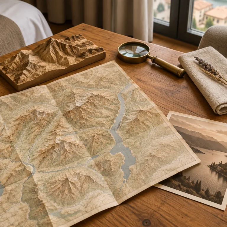
Reading the mountains in Italy map from a Milan hotel room
From a hotel window in Milan, the skyline hints at distant mountains. A detailed mountains in Italy map turns that hazy outline into a clear plan for lakeside escapes and countryside retreats. With the right cartography, you can match each Italian mountain landscape to a specific day trip that fits your schedule.
Look first to the north, where northern Italy rises quickly from the Po Valley into the Alps and the northern Apennines, giving you a precise sense of travel times and altitude changes. On a good topographic map of Italy’s mountains, the Alps and the Apennine Mountains appear as distinct ranges, helping you understand which valleys lead to lakes and which to high passes. This visual separation between the Alps and every Apennine chain is crucial when you are choosing between gentle walks and serious climbs.
Most Milan visitors focus on the Alps, yet the broader Italian mountain system stretches from the west to the east and then down through central Italy into southern Italy. A careful look at a mountains in Italy map reveals how the Apennines form a spine through the peninsula, with each Apennine section offering different styles of forests, river gorges, and rural villages. When you see how close these mountains are to the city, booking a hotel in Milan becomes a strategic choice rather than a compromise.
From Milan to lakes and valleys: choosing your base with the map
When you study a mountains in Italy map, the first thing that stands out is how the Alps shelter the great northern lakes. Lake Como, Lake Maggiore, and Lake Garda sit in deep valley basins carved by ancient glaciers, and each valley has its own character and microclimate. Staying in Milan lets you sample several of these valleys in one trip, instead of committing to a single lake resort.
On the map, trace the arc of the Alps from west to east above northern Italy, then follow the line of the Apennines as they run south from near Genoa through the central Apennines and on toward the southern Apennines. This contrast between the Alps and the Apennine Mountains explains why some lakes feel dramatically alpine while others feel more Mediterranean, with softer hills and forests that roll gently toward the sea. If you plan to use Milan as a base for lakes and countryside escapes, this geographic context matters as much as hotel amenities or room size.
For guests timing their stay around quieter landscapes, autumn in Italy makes Milan the perfect base for lakes and countryside escapes, and a mountains in Italy map shows why the colours peak at different moments in each valley. Higher mountain ranges near the highest peaks around Mont Blanc and Gran Paradiso change earlier, while lower Apennine slopes in central Italy and southern Italy hold their foliage longer. Understanding these gradients helps you choose both your travel dates and your preferred Milan neighbourhood with more confidence.
Planning refined rail escapes from a single Milan hotel base
A mountains in Italy map becomes even more powerful when you overlay it mentally with the rail network radiating from Milan. Fast trains run north toward the Alps and the highest peaks, while regional lines branch into side valleys that feel far removed from the city. From a single hotel base, you can reach lakes, national parks, and quiet mountain villages without renting a car.
Look at how the Alps curve above northern Italy, then note the rail corridors that follow each river valley toward the highest mountain areas. Lines toward Tirano and Domodossola bring you close to the Swiss border, where the Alps rise sharply and the mountains in Italy map shows tight contour lines around each monte and gran summit. Other routes head east toward Verona and the Adige River corridor, where lower mountain ranges frame the approach to Lake Garda and the Dolomites.
For structured ideas, many travellers use curated suggestions for day trips from Milan by train as refined rail escapes from a single hotel base, then cross check each option against a mountains in Italy map. This combination reveals which national parks are realistic for a day trip and which valleys deserve an overnight stay. It also clarifies how far you need to travel from your Milan hotel to experience genuine alpine or Apennine landscapes rather than just low hills.
Understanding Italy’s major mountain ranges from a Milan perspective
To read a mountains in Italy map with confidence, start by distinguishing the Alps from the Apennines. The Alps form a high arc along the northern border of Italy, while the Apennine Mountains run down the centre of the peninsula from north to south. Milan sits just south of the Alps and west of the northern Apennines, which makes it an ideal vantage point for both systems.
On the western side, the Alps near Mont Blanc and Gran Paradiso contain some of the highest peaks in Europe, and the highest mountain in Italy is Monte Bianco, which many maps label with its French name Mont Blanc. These highest peaks create a dramatic wall that shapes weather patterns across northern Italy, feeding glaciers, forests, and every major river that flows into the Po Valley. When you look at a mountains in Italy map, you can see how these mountains channel cold air and snow toward ski resorts while leaving Milan relatively mild.
To the east and south, the Apennine ranges are lower but more continuous, forming the backbone of central Italy and southern Italy. The northern Apennines near Emilia Romagna rise gently from the plains, while the central Apennines and southern Apennines become wilder, with deep valley systems and rugged national parks. For a Milan hotel guest, this means you can choose between a quick excursion into the northern Apennines or a longer journey toward central Italy for more remote landscapes.
National parks, seas, and rivers that shape countryside escapes
When you zoom out on a mountains in Italy map, the interplay between mountains, seas, and rivers becomes clear. The Alps and Apennines feed major rivers such as the Po and the Tiber River, which in turn define fertile plains and historic routes. These waterways, together with the Adriatic Sea and the Tyrrhenian Sea, frame many of the most appealing countryside escapes reachable from a Milan hotel.
Italy’s national parks cluster around its mountain ranges, and the maps of these protected areas help you understand which landscapes are accessible in a single day. Gran Paradiso National Park in the western Alps offers high alpine meadows, glaciers, and some of the highest viewpoints you can reach without technical climbing, while other national parks in the central Apennines protect wolves, ancient beech forests, and remote villages. From Milan, you can use a mountains in Italy map to compare travel times to each park and decide whether to prioritise alpine or Apennine scenery.
Although Milan itself sits far from the open sea, the map shows how the Tyrrhenian Sea lies to the west and the Adriatic Sea to the east, each separated from the city by different Apennine sections. Coastal national parks often combine mountain and sea views, with forests dropping steeply toward the shoreline and river valleys cutting through limestone cliffs. If you plan a longer stay in Milan, you can use this geographic overview to add a coastal detour to your sequence of lake and mountain day trips.
Choosing the right Milan hotel for mountain focused escapes
Once you understand the mountains in Italy map, you can choose a Milan hotel that aligns with your preferred direction of travel. Guests who plan frequent trips toward the Alps and northern Italy often favour locations near Milano Centrale or Porta Garibaldi, where trains depart quickly toward the north and east. Those more interested in the Apennines, central Italy, or southern Italy may prefer easier access to Milano Rogoredo or Porta Romana, which connect efficiently toward Bologna, Emilia Romagna, and Rome.
If nightlife and canals appeal after a day in the mountains, staying near Milan’s Navigli canal district for nightlife offers a balance between urban energy and countryside calm. From there, you can reach key rail hubs by metro in the morning, then return to waterside bars and restaurants in the evening. This pattern works especially well for travellers who alternate intense hiking days in the Alps or Apennine Mountains with slower cultural days in the city.
When comparing hotels, consider how early you want to reach the first valley on your itinerary and how late you expect to return from the highest peaks or distant national parks. A property close to a major station can save an hour each way, which matters if you are heading toward Mont Blanc, Gran Paradiso, or the central Apennines for a full day. Aligning your hotel choice with the geography on the mountains in Italy map ensures that your time in Milan feels like a seamless sequence of alpine, Apennine, and urban experiences.
Key figures that bring the mountains in Italy map to life
- Mont Blanc / Monte Bianco, on the border between Italy and France, is the highest peak in Italy at 4 808 metres above sea level, which explains why the western Alps dominate any mountains in Italy map of northern Italy (data from the Italian Alpine Club).
- Gran Paradiso, entirely within Italian territory, reaches 4 061 metres and is the highest mountain located fully inside Italy, making Gran Paradiso National Park a prime target for Milan based hikers seeking true high alpine terrain (data from Gran Paradiso National Park).
- The Apennines stretch for roughly 1 200 kilometres from the north near Liguria to the southern tip of the peninsula, which means that Apennine landscapes are accessible from Milan in multiple directions, from the northern Apennines near Emilia Romagna to the central Apennines near Rome (data from the Italian National Research Council).
- Italy counts more than 25 national parks, and a significant share of these national parks protect alpine or Apennine ecosystems, so a careful reading of the mountains in Italy map helps Milan visitors identify which protected areas are realistic for day trips and which require overnight stays (data from the Italian Ministry for the Environment).
- The Tiber River, which flows through Rome, has its source in the Apennines at about 1 268 metres of altitude on Monte Fumaiolo, illustrating how even major Italian rivers begin in relatively modest Apennine peaks that appear clearly on detailed maps (data from the Italian Geographic Military Institute).
FAQ about using a mountains in Italy map from Milan
Which mountains are easiest to reach from a Milan hotel for a day trip ?
The closest high mountains to Milan are in the Alps around Lecco, Como, and the Valtellina, which you can reach by train in about one to two hours. Lower Apennine ranges near Emilia Romagna are also feasible for a long day, especially if you take early trains toward Bologna or Parma. A mountains in Italy map helps you see that alpine valleys north of the city generally require less travel time than the central Apennines or southern Apennines.
How can a mountains in Italy map help me choose my Milan neighbourhood ?
If you plan frequent trips toward the Alps and northern Italy, a map shows that staying near stations with direct northbound lines will minimise transfers. Travellers focused on Apennine landscapes in central Italy or southern Italy may prefer easier access to southbound routes toward Emilia Romagna and Rome. Matching your hotel location to your preferred mountain ranges reduces commuting time and increases your hours on the trail or by the lake.
Are Italy’s highest peaks realistic to visit from Milan without a car ?
Reaching the highest point areas around Mont Blanc and Gran Paradiso from Milan without a car is possible but requires careful planning and early departures. Trains and buses connect Milan to Aosta Valley and other alpine hubs, from which cable cars and local transport bring you closer to the highest peaks. A mountains in Italy map, combined with current timetables, helps you judge whether to attempt these as long day trips or to book an overnight stay near the national parks.
What is the difference between the Alps and the Apennines for a Milan based traveller ?
The Alps north and west of Milan offer higher peaks, glacial valleys, and classic alpine scenery, which appear on maps as dense contour lines and sharp relief. The Apennines, especially the northern Apennines and central Apennines, are generally lower but more continuous, with rolling ridges, forests, and traditional villages. From a Milan hotel, this means alpine trips often focus on dramatic views and cable cars, while Apennine excursions emphasise quieter trails, rural food, and historical routes toward Rome.
Can I combine lakes, mountains, and sea during one stay in Milan ?
A mountains in Italy map shows that lakes, mountains, and both the Adriatic Sea and the Tyrrhenian Sea are within reach of Milan, though not all as simple day trips. In a week, many travellers manage two or three lake days in the Alps, one Apennine excursion, and a longer outing toward either coast. The key is to use the map to understand distances and elevation changes, then choose a Milan hotel with convenient access to the rail lines that serve your chosen valleys and coastal areas.